Lake Wakatipu
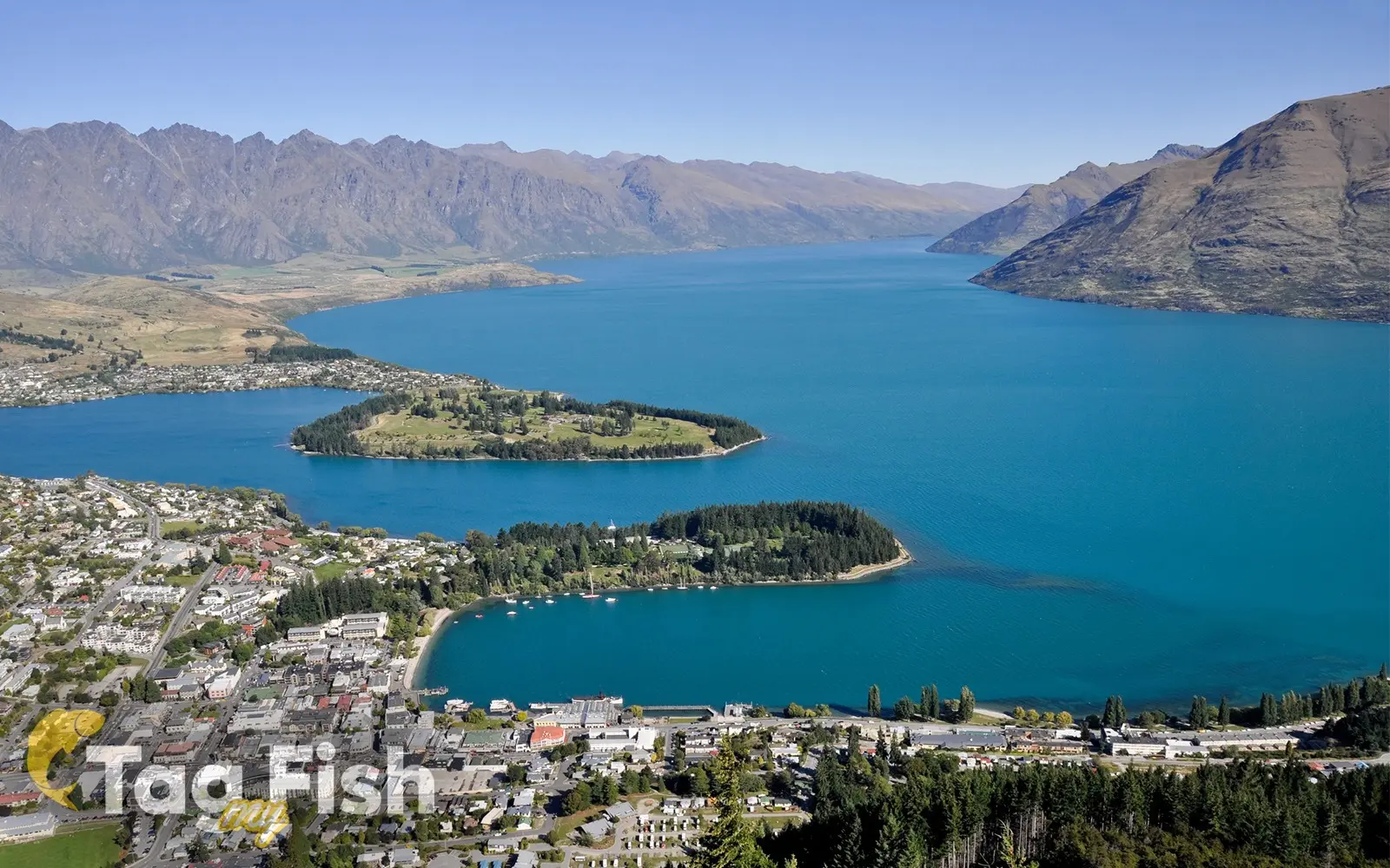
Image source: Image licensed under subscription from 123rf.com
General data
- Name: Lake Wakatipu
- Water system: Clutha River
- Water type: Natural lake
- Progression: Kawarau River -> Lake Dunstan -> Clutha River -> Pacific Ocean -> Planet Earth
- Climates: Temperate
- Continents: Australia & Oceania
- Countries: New Zealand
Lake Wakatipu (Māori: Whakatipu Waimāori) is an inland lake (finger lake) in the South Island of New Zealand. It is in the southwest corner of the Otago region, near its boundary with Southland. The name Wakatipu comes from the Māori name of the lake; there are two different etymologies as to the origin of the name.
With a length of 80 kilometres (50 mi), it is New Zealand's longest lake, and, at 295 km2 (114 sq mi), its third largest.
The lake is also very deep, its floor being below sea level (−111 metres, or 364 feet), with a maximum depth of 420 metres (1,380 ft).
It is at an altitude of 309 m (1,014 ft), towards the southern end of the Southern Alps. The general topography is a reversed "N" shape or "dog leg".
The Dart River flows into the northern end, the lake then runs south for 30 kilometres before turning abruptly to the east. Twenty kilometres (12 miles) further along, it turns sharply to the south, reaching its southern end 30 kilometres (19 mi) further south, near Kingston. At the north end of the lake is the settlement of Glenorchy, in the north-east corner, and the smaller isolated locality of Kinloch in the north-west corner.
The lake is drained by the Kawarau River, which flows out from the lake's only arm, the Frankton Arm, 8 km (5.0 mi) east of Queenstown. Until about 18,000 years ago the Mataura River drained Lake Wakatipu. The Kingston Flyer follows part of the former river bed now blocked by glacial moraine. Queenstown is on the northern shore of the lake close to the eastern end of its middle section. It has a seiche period of 26.7 minutes which, in Queenstown Bay, causes the water level to rise and fall some 200 millimetres (8 in).