Lake Hauroko
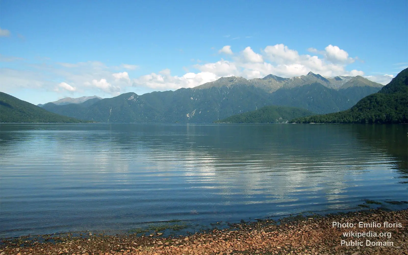
Image source: Emilio floris
General data
- Name: Lake Hauroko
- Water system: Wairaurahiri River
- Water type: Natural lake
- Progression: Wairaurahiri River -> Foveaux Strait -> Tasman sea -> Pacific Ocean -> Planet Earth
- Climates: Temperate
- Continents: Australia & Oceania
- Countries: New Zealand
Lake Hauroko is the deepest lake in New Zealand, reaching an impressive depth of 462 metres (1,516 ft). Located within the spectacular Fiordland National Park on the South Island, the lake occupies a long mountain valley carved by ancient glaciers and is renowned for its pristine wilderness and dramatic scenery.
The name "Hauroko" comes from the Māori language and is commonly translated as "soughing of the wind" or "sounding wind," reflecting the area's often windy conditions. Before 1930, the lake was also known as Lake Hauroto.
Stretching approximately 32 kilometres (20 miles) in length and covering an area of about 65 square kilometres (25 square miles), Lake Hauroko has a distinctive S-shaped outline. Its surface lies around 155 metres (509 ft) above sea level, while its remarkable depth places it among the deepest lakes on Earth.
Lake Hauroko is one of New Zealand's southernmost lakes, situated only 13 kilometres from the southern coast of the South Island. It lies between Lake Monowai and Lake Poteriteri and drains westward through the 20-kilometre-long Wairaurāhiri River before emptying into Foveaux Strait near Te Waewae Bay.
The largest island in the lake is Mary Island, named in 1883 after the wife of government surveyor John Hay. A smaller island lies near Teal Bay at the southern end of the lake, while several additional rocky islets are scattered across its clear waters. Surrounded by untouched native forest and rugged mountains, Lake Hauroko remains one of New Zealand's most remote and unspoiled freshwater landscapes.
