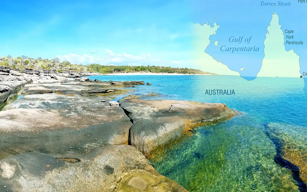
Gulf of Carpentaria
General data
- Name: Gulf of Carpentaria
- Basin: Pacific Ocean
- Water type: Bay
- Progression: Pacific Ocean -> Planet Earth
- Climates: Tropical
- Continents: Australia & Oceania
- Countries: Australia
Description
The Gulf of Carpentaria is a large, shallow sea enclosed on three sides by northern Australia and bounded on the north by the eastern Arafura Sea (the body of water that lies between Australia and New Guinea). The northern boundary is generally defined as a line from Slade Point, Queensland (the northwestern corner of Cape York Peninsula) in the northeast, to Cape Arnhem on the Gove Peninsula, Northern Territory (the easternmost point of Arnhem Land) in the west. At its mouth, the Gulf is 590 km (370 mi) wide, and further south, 675 km (420 mi). The north-south length exceeds 700 km (430 mi). It covers a water area of about 300,000 km2 (120,000 sq mi). The general depth is between 55 and 66 metres (30 and 36 fathoms) and does not exceed 82 metres (45 fathoms). The tidal range in the Gulf of Carpentaria is between two and three metres (6.5 and 10 ft). The Gulf and adjacent Sahul Shelf were dry land at the peak of the last ice age 18,000 years ago when global sea level was around 120 m (390 ft) below its present position. At that time a large, shallow lake occupied the centre of what is now the Gulf. The Gulf hosts a submerged coral reef province that was only recognised in 2004. Coral reefs The Gulf of Carpentaria is known to contain fringing reefs and isolated coral colonies, but no near-surface patch or barrier reefs exist in the Gulf at the present time. However, this has not always been the case. Expeditions carried out by Geoscience Australia in 2003 and in 2005 aboard the RV Southern Surveyor revealed the presence of a submerged coral reef province covering at least 300 km2 (120 sq mi) in the southern Gulf. The patch reefs have their upper surfaces at a mean water depth of 28.6 ± 0.5 m (94 ± 1.5 ft), were undetected by satellites or aerial photographs, and were only recognised using multibeam swath sonar surveys supplemented with seabed sampling and video. Their existence points to an earlier, late Quaternary phase of framework reef growth under cooler-climate and lower sea level conditions than today. Major rivers In the Top End, the Roper River, Walker River and Wilton River flow into the Gulf. The Cox River, Calvert River, Leichhardt River, McArthur River, Flinders River, Norman River and the Gilbert River drain the Gulf Country. A number of rivers flow from the Cape York Peninsula into the Gulf, including Smithburne River, Mitchell River, Alice River, Staaten River, Mission River, Wenlock River, and Archer River.

